Syilx Member Communities
The Okanagan Nation Alliance (ONA), established in 1981, is the inaugural First Nations government for the Syilx Nation. Our traditional Syilx territory includes the Okanagan Indian Band, Upper Nicola Band, Westbank First Nation, Penticton Indian Band, Osoyoos Indian Band, Lower and Upper Similkameen Indian Bands, and the Colville Confederated Tribes.
The member communities that comprise the Okanagan Nation Alliance today are:
- Upper Nicola Band
- Okanagan Indian Band
- Westbank First Nation
- Penticton Indian Band
- Osoyoos Indian Band
- Lower Similkameen Indian Band
The Upper Nicola Band (UNB) is located 35 km east of Merritt and 67 km south of Kamloops, British Columbia. The UNB has eight reserves (1600 hectares, numbered 1 through 8, which are located in the surrounding area of Quilchena (Nicola Lake) and Spaxomin (Douglas Lake).
The Okanagan Indian Band (OKIB) is located at the head of Okanagan Lake, with a land base of 11,282.5 hectares. OKIB is made up of six reserves and spread from Armstrong to Winfield and Westside of Okanagan Lake.
The Westbank First Nation (WFN) comprises five reserves totaling 2,161 Hectares (5,306 acres). The two populated reserves, Tsinstikeptum Reserves 9 and 10, border Okanagan Lake and are in close proximity to the City of West Kelowna, one of the fastest growing cities in British Columbia. The remaining three reserve areas are located on the east side of Okanagan Lake in the Kelowna area and lie in generally unpopulated areas.
The Penticton Indian Band (PIB) comprises 3 reserves with a 19,436 hectare land base and is located four kilometers from the Penticton City limits. Geographically PIB has the largest land base and is bordered to the north by the city of Summerland, to the west by the City of Penticton and to the South and West by Highway 97.
The Osoyoos Indian Band (OIB) is located in the Southern part of of the Okanagan Valley, between the towns of Oliver and Osoyoos and covers 13,045 hectares of land base.
The Lower Similkameen Indian Band (LSIB) is a small, geographically isolated community in the Similkameen Valley, located in the South Okanagan. The Lower Similkameen Indian Reserve covers 15,276.4 hectares and services a total of 11 reserves, divided into pockets of land stretching over 90 kilometers.
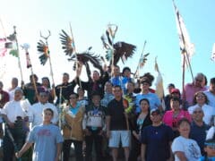
Header Image: Aaron Hemens, IndigiNews
See Also
Suggested Resources

Syilx Territory
Land Acknowledgements